Project highlights, community benefits, and general information for both the Ruskin and Wimauma S2S projects
Ruskin
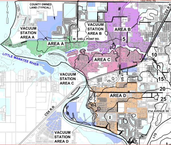
Four (4) wastewater collection areas have been proposed for Ruskin: Area A, B, C, D.

- Area A lies in the western portion of Ruskin along West Shell Point Road
- Area B lies in the northern region of Ruskin. It is bounded on the south by the Ruskin Inlet and the Marsh Branch. Much of the area to the east and west is already served with gravity or consists of large vacant parcels and are not included in the project boundary.
- Area C lies in the western portion of Ruskin along College Ave W. The area is bounded on the southeast side by the CSX Railroad and by the Ruskin Inlet to the north and the Little Manatee River on the west.
- Area D lies in the southern region of the Ruskin study area along 1st Street S.W. and is bounded on the North by the CSX Railroad and on the west side by the Little Manatee River
Wimauma
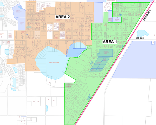
Two (2) wastewater collection areas have been proposed for Wimauma: Area 1 and Area 2.

- Area 1 lies in the eastern region of Wimauma. It is bounded on the east by Edina St. and on the west side by large vacant lots, Lake Wimauma, and Sheffield St. The north and south regions are bounded by large tracts of land excluded from the project.
- Area 2 lies in the central region of Wimauma. It is bounded on the north side by large tracts of land and areas served by gravity sewer. The southeast border is limited by Lake Wimauma. The western region is bordered by gravity sewer areas and one area is currently served with Low Pressure Sewer System (LPPS).
See larger versions of all Ruskin & Wimauma S2S Project Images

